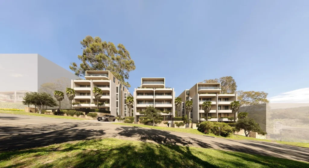
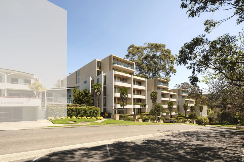
A $95 million development featuring three six-storey apartment buildings in Mona Vale is now on public exhibition. The project is one of the first local test cases for the NSW Government’s low and mid-rise housing reforms.
The application, lodged as a State Significant Development, applies to a 6,122m² site at 159–167 Darley Street West. It proposes 82 apartments, 164 car spaces across three basement levels, and more than 3,000m² of landscaped area. The development must balance new density with environmental constraints and local character.
Rezoning unlocked development potential
In April 2025, planning authorities rezoned the land from R2 Low Density to R3 Medium Density under the Pittwater LEP 2014. This change added the site to the LEP’s Biodiversity Map and introduced a 5% affordable housing requirement.
However, the site remained constrained by Clause 4.5A, which imposed a dwelling density limit. In September 2025, after representations by the applicant, the Department amended the LEP to remove this restriction. This change allowed the development to fully access uplift under the Housing SEPP’s low and mid-rise provisions.
Design seeks to manage scale and context
The proposed buildings would rise to six storeys in an area mostly defined by detached houses and smaller apartments. The site fronts Darley Street West and slopes towards bushland and flood-affected land to the south.
To respond to this context, the design uses setbacks, staggered building forms, and coastal-inspired materials. Each building is separated by landscaped open space. According to the applicant, this layout reduces visual bulk and integrates with the sloping topography.
Even so, the assessment will need to test whether the proposed height and massing fit with Mona Vale’s established character.
Environmental management is a key issue
The site includes an overland flow path and remnant native vegetation classified as Hunter Coast Lowland Spotted Gum Moist Forest. While no threatened species were found, the proposal must still manage flood and biodiversity risks.
To reduce impact, Building C spans the flood path on columns. This design maintains natural drainage and avoids excavation in the flow corridor. Building B is also set back to preserve vegetation.
The project involves removing 58 trees, including 37 exempt species. The landscape plan proposes planting 84 native trees to offset this loss. Deep soil zones cover 38% of the site, and a rear bushwalk provides both amenity and ecological value.
Access, transport and parking arrangements
Vehicular access is proposed from Darley Street West. Three basement levels provide 164 car spaces, 27 bicycle spaces, and two motorcycle bays. While the proposal claims to meet SEPP and DCP parking rates, traffic impacts and pedestrian links remain under review.
Notably, there is no footpath along the site’s frontage. However, the site lies within 300 metres of a local bus stop and less than one kilometre from the B-line express service.
Planning metrics and landscape strategy
The gross floor area is 10,928m², with a floor space ratio of 1.8:1. The tallest point reaches 21.175 metres. The development includes 50.5% landscaped area and 25.4% communal open space.
Two key communal areas are proposed: a central landscaped podium and a rear bushwalk. These spaces are intended to improve residential amenity and maintain a connection to the surrounding landscape. However, the quality of these spaces and the net loss of mature vegetation are likely to attract scrutiny.
A test case for housing reform in established suburbs
This proposal is among the first in the area to apply the State’s low and mid-rise housing reforms. Its success or failure could influence how similar developments proceed in flood-prone or environmentally sensitive suburbs.
Importantly, the public exhibition period will help reveal whether the proposal meets local expectations. No detailed community or agency submissions appear in the exhibition materials, making this next phase critical.
Project Team
- Developer: The Trustee for DREP1 Mona Vale Sub Trust
- Planning: Colliers Urban Planning
- Architecture: PBD Architects
- Landscape: Arcadia
- Costing: Napier Blakely
- Community Engagement: Notting Hill
- Transport: CTP
- Arboriculture: Tree Wise Men
- ESD/BASIX: Greenview
- Flooding: Martens
- Geotechnical/Contamination: EI Australia
- Aboriginal Heritage: Urbis
- Community Housing Provider: Link Wentworth
For more information, search the application number (SSD-91496958) on the Department of Planning, Housing and Infrastructure’s website.


